Trails.Idaho.gov
The most comprehensive list of Idaho trails that I’ve found is Trails.Idaho.gov. They have all of the trails that I’ve ever looked for and have motorized as well as non-motorized trails. Maps can be produced from this system that also have weather or fire overlays on them.


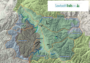
SawtoothTrails.org
An awesome Google Maps based site that allows you to search for a hike, create your own maps for specific trails, and export for GPS devices. This site is focused on making sure that hikers are prepared and safe.
Idaho’s National Historic Trails
National Historic Trails (NHT) and National Scenic Trails (NST) can be found at the following link Six are located in Idaho (Lewis and Clark NHT, Nez Perce NHT, Oregon NHT, California NHT, Continental Divide NST, and Pacific Northwest NST).
Idaho’s National Recreation Trails
American Trails is a database of the National Recreation Trails (NRT) and 46 are listed in Idaho.
Idaho’s Eleven National Natural Landmarks
Idaho’s Wilderness Areas
Hosted by Wilderness.net, this links provides a list of Wilderness areas in Idaho, and map showing the location.
Idaho’s Ten National Forests
Idaho is home to ten National Forests as listed here along with a vicinity map showing the location of each. A link will take you to a summary description of each forest.
Idaho’s BLM Districts
The BLM manages nearly 12 million acres of public lands in Idaho, nearly one-fourth of the state’s total land area, for multiple uses. And within the BLM site, they have a plethora of other links to recreational trail use opportunities. And, this BLM site has additional links to Georeferenced PDF maps available for download to your smart phone.